|

Click to Enlarge Map
Links:
The Voice/Vision
Holocaust Survivor Oral History Archive
Unless noted, all photos are by Jamie L. Wraight
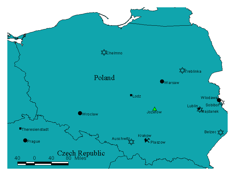
Map not to scale. The purpose of this map is to show spatial relationships between places,
it
is not to be used as a navigational device. International boundaries depicted
on this map are
present-day, therefore, although specific places remain consistent, the countries where such places are
located have changed in some instances.
Data contained in this map is drawn from several sources, including:
Environmental Systems Research Institute Inc. ESRI Data & Maps, Disc 1. Redlands, CA,
1999.
Gilbert, Martin. Atlas of the Holocaust. (New York: William Morrow & Co., 1993).
Mokotoff, Gary and Amdur Sack, Sallyann. Where We Once Walked: A Guide to Jewish
Communities Destroyed in the Holocaust. (Teaneck, N.J.:
Avotaynu, Inc., 1991).
United States Holocaust Memorial Museum. Historical Atlas of The
Holocaust. (New York:
Macmillan, 1996).
PLEASE NOTE: The map shown here is for illustrative purposes only and
is not suitable for
site-specific decision making. The data depicted is compiled from a variety of sources, thus this
information is provided with the understanding that the conclusions drawn from such information
are solely the responsibilities of the user. Any assumption of the legal status of this data is hereby
disclaimed. Map is not to scale
|